Skip links

What we provide?

Schedule an appointment

    Name

    E-mail adress

    (Optional)

    Subject

    Your message

    Phone:

    +40 726 686 722

    3D Aerial Scanning

    Through drones, we perform spatial data collection for extensive areas, monitor project progress, and support urban planning processes.

    What is 3D Aerial Scanning?

    Using drones equipped with LiDAR technology and high-resolution optical sensors, rapid spatial data collection is performed for extensive surfaces, which is fundamental for topographic studies, infrastructure monitoring, and site planning processes.

    3D Aerial Scanning Benefits

    How We Approach 3D Aerial Scanning

    We provide assessment of land registries, analysis of the regulatory framework, and development of geospatial planning, aiming to align cadastral projects with performance indicators set by public administrations and real estate developers.

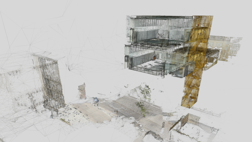
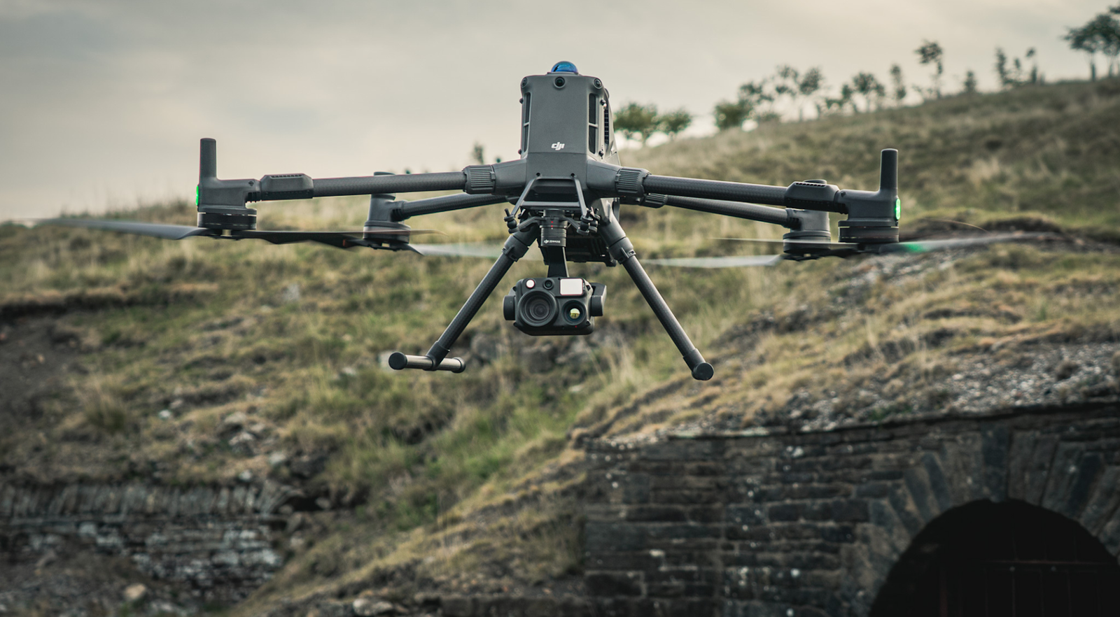
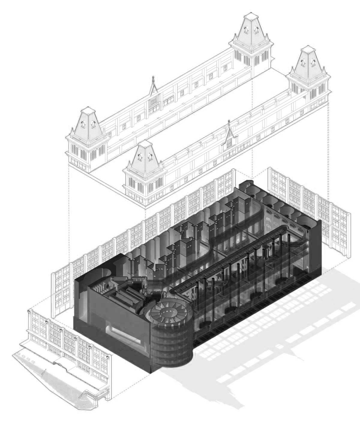
    By utilizing high-precision LiDAR technologies, aerial drone mapping, and measurements, we perform georeferenced property demarcation and prepare the associated cadastral and legal documentation, ensuring compatibility and integration with national land registry records.

    We ensure real-time monitoring of changes in property rights, as well as analysis of developments and trends in asset management.

    Photography

    Brooklyn Residence

    Interior design is the art and science of enhancing the interiors, sometimes including the exterior, of a space or building, to achieve a healthier and more aesthetically pleasing environment.

    Partner

    LiquidThemes

    Role

    Architect

    Date

    June 2022

    Deliverables

    Concept Design

    Acest site web utilizează cookie-uri pentru a îmbunătăți experiența dvs. de navigare.